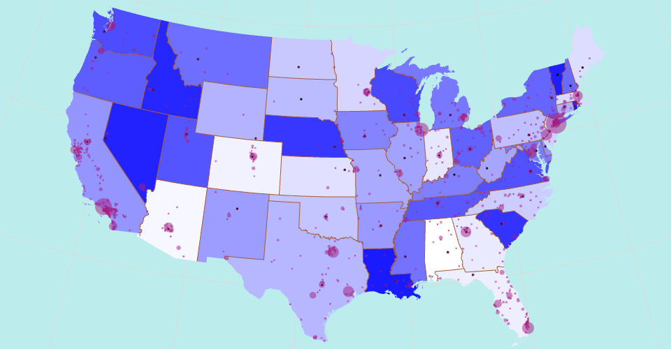
A US map showing states boundaries from US Atlas TopoJSON, polished for visual style, including graticules.
This map shows all US continental states with random colors from a white to blue linear color scale. Two groups of cities are showing on the map. The first group of cities comes from world cities database screened with US cities only. They have population information, which show up corresponding to the size of the circle for each city. The second group of cities are US states capitals, which show as fixed size black dots. This is a json file which can be found in [vega docs data] (https://github.com/vega/vega/tree/master/docs/data) on github.
MIT Licensed