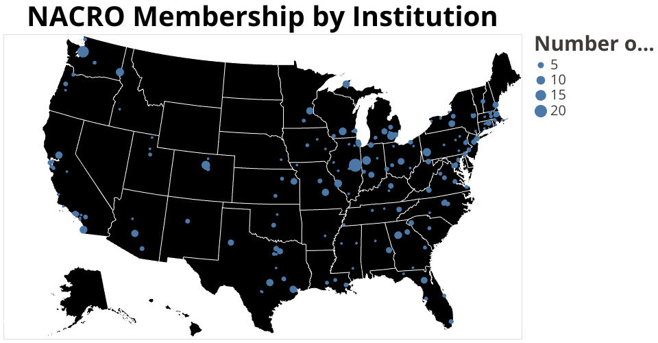
NACRO membership by institution plotted using geographic coordinates for institutions from the College Scorecard Dataset. The data comes from the NACRO Member Geography dataset. This is the second visualization, working with a map.
The map shows where NACRO members are located, and which institutions have more (or fewer) members. NACRO would like to enable members to connect with each other, formally through regional groups, and informally. Eventually, I'd like to make the map interactive to show member contact information when you click on an institution, and maybe also to generate a list of members by region. I'm happy to have connected NACRO institution names with geographic coordinates, so that I can now pull in other NACRO survey results and show them geographically. At a more minor level, for this map, it would be good to show both the institution name and the number of members on the tooltip, but I couldn't figure out how to make two variables show up. I forked this from another student's map, credit where credit is due.