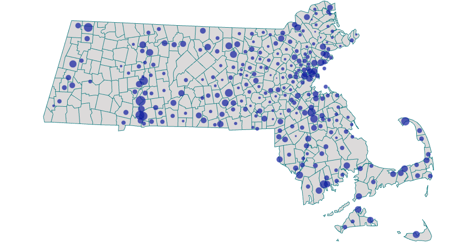
This Map show Crime rate in different township of Massachusetts
original crime data is from FBI 2016 download from here
Geo Shape file are from here
The download Shape file did not contain coordination. Therefore, it is first converted to geojson by ogr2ogr
Geojson then reprocessed by mapshaper to Topojson.
Topojson file is loaded to Github gist
Crime data csv is loaded to gist
circle size is corresponding to the crime rate
MIT Licensed