🌍 Public
Fork of Choropleth Map with Interactive Filtering
VVincent Oti
Last edited Jun 21, 2022
Created on Jun 21, 2022
Forked from Choropleth Map with Interactive Filtering
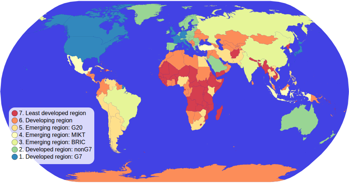
This choropleth map displays global economic classifications by country, with a color legend that doubles as an interactive filter. Clicking a legend item dims all countries except those matching the selected category, while hovering over the map highlights a country in red. The visualization uses D3 v5’s `scaleOrdinal` with a spectral color scheme and `geoPath` with the Natural Earth projection to render the map. Country boundaries and income data come from the world-atlas TopoJSON, and spatial interaction is handled by D3’s `zoom` event system.
AI-generated descriptionA choropleth map where you can hover over items in the color legend items to interactively filter!
MIT Licensed




Comments
Sign in to join the discussion.