🌍 Public
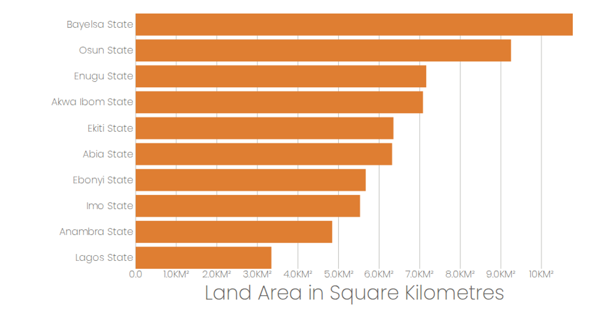
Largest State in Nigeria Land Area
This example displays the ten largest states in Nigeria ranked by land area using a horizontal bar chart. The bars are colored orange and rendered as SVG rectangles via React components, with state names on the y-axis and land area in square kilometers on the x-axis. The visualization uses D3 v5 scales (scaleBand, scaleLinear) and format functions, along with React hooks (useState, useEffect) to load CSV data from a GitHub gist. Tooltips provide precise area values when hovering over each bar.
AI-generated descriptionDataset of the largest state in Nigeria by land area constructed by Niran Software Solution
MIT Licensed





Comments
Sign in to join the discussion.