🌍 Public
Choropleth Map with Interactive Filtering
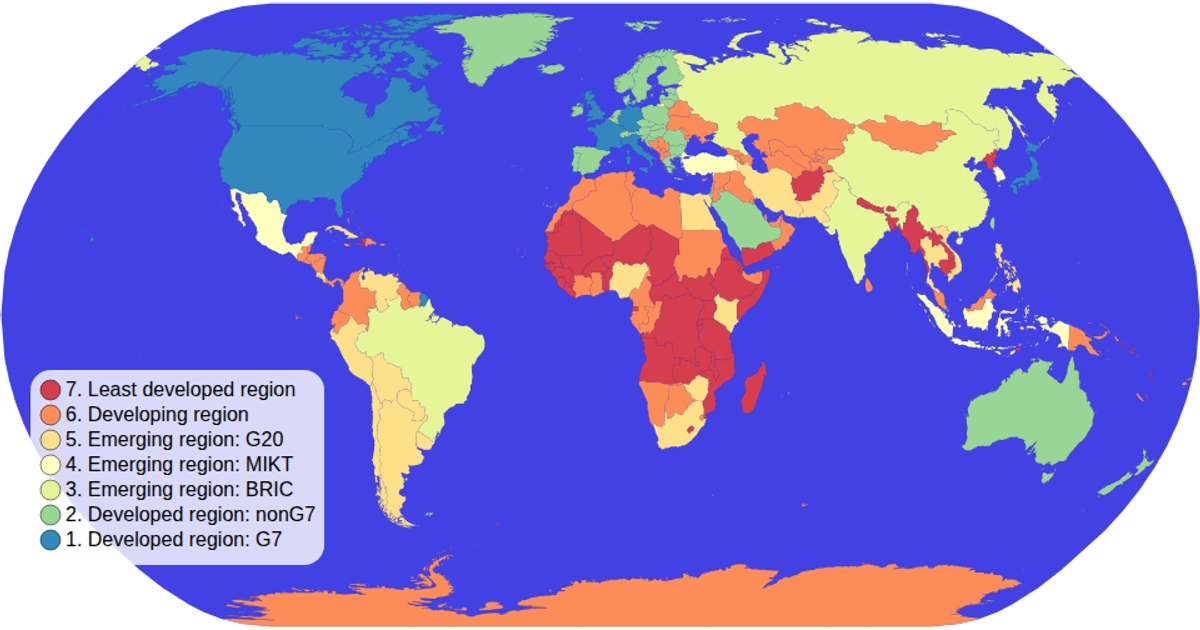
This choropleth map displays world countries colored by World Bank region, with an interactive legend that filters the map when clicked. A legend item dims all countries except those matching the selected region, and clicking the same item again clears the filter. The visualization uses D3 v5 with d3.geoConicEquidistant projection and d3.geoPath for rendering SVG paths, while the legend is built with d3.scaleOrdinal and d3.schemeSpectral. Data comes from the world-atlas TopoJSON dataset, and d3.zoom enables panning and zooming.
AI-generated descriptionA choropleth map where you can hover over items in the color legend items to interactively filter!
Forked while learning a tutorial online.
MIT Licensed


Comments
Sign in to join the discussion.