🌍 Public
Fork of Fork of Choropleth Map with Interactive Filtering
Yyihsuan
Last edited Dec 18, 2023
Created on Dec 18, 2023
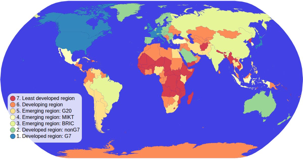
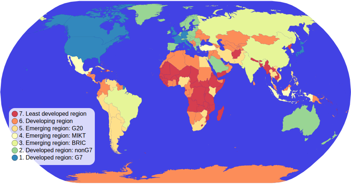
This choropleth map colors world countries by their economy group, using a spectral color scale. Users can click any color legend swatch to isolate that economy category, while all other countries fade to low opacity. Hovering a country highlights it in red. The map renders with `d3.geoPath`, updated via a D3 zoom interaction, while `d3.scaleOrdinal` and `d3.schemeSpectral` drive the categorical colors. Data comes from the `world-atlas` package, joined with TSV income-group values.
AI-generated descriptionA choropleth map where you can hover over items in the color legend items to interactively filter! Background to black
MIT Licensed




Comments
Sign in to join the discussion.