Migrant Deaths Linked Views with Fast Brushing
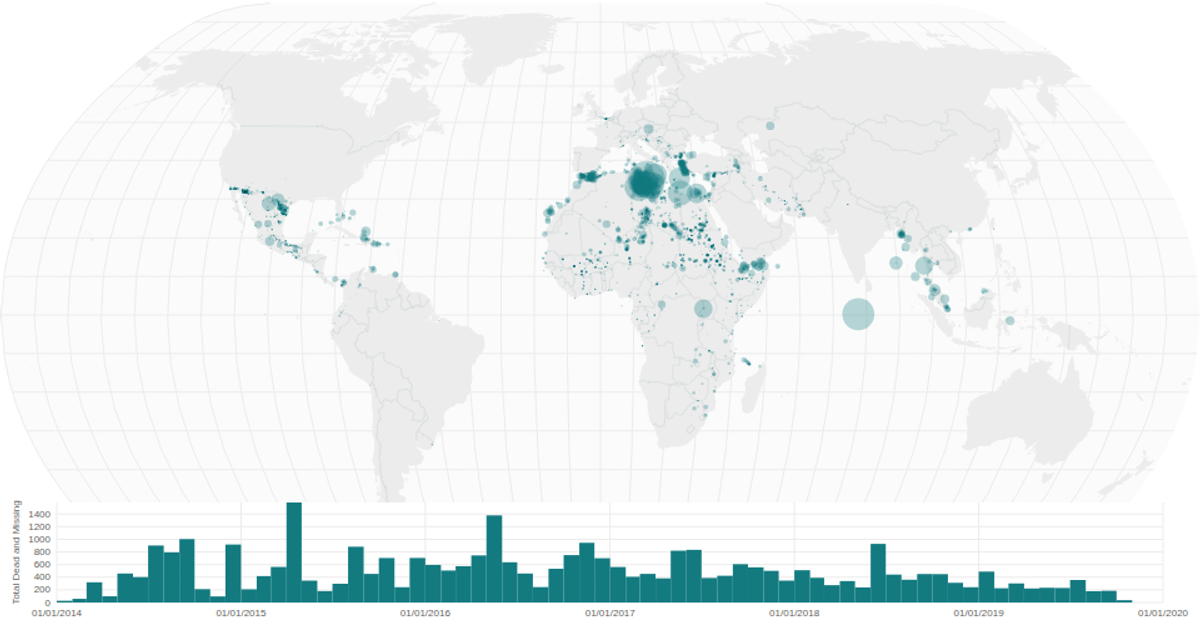
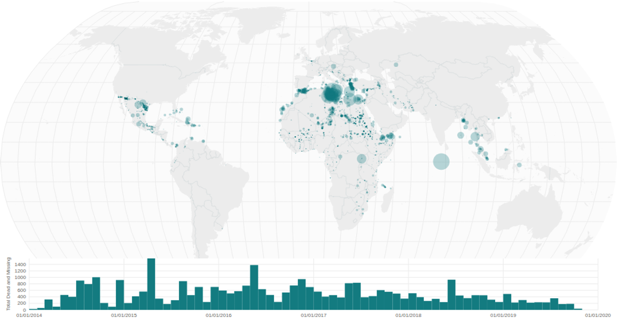
This interactive dashboard visualizes migrant deaths over time and location on a world map. A histogram displays the monthly count of dead and missing individuals, allowing users to brush a time range, which immediately filters and highlights the corresponding incidents on the map. Built with React and D3, the visualization uses `d3.geoPath` for map projections, `d3.brushX` for the time selection, and `useMemo` to optimize rendering performance. The temporal and spatial views are linked, enabling rapid exploration of the data.
AI-generated descriptionA world map showing cities with population greater than 50,000. City data from Simplemaps: World Cities Database.
Country boundaries from World Atlas TopoJSON, polished for visual style, including graticules.
This iteration is optimized for performance using React's useMemo hook.




Comments
Sign in to join the discussion.