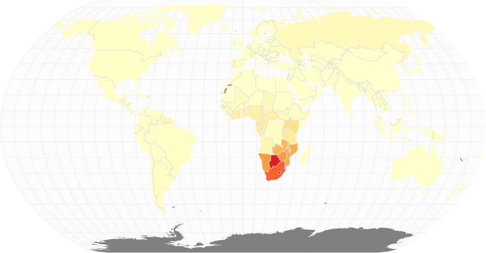
A choropeleth map showing HIV/AIDs population distrbution.
Country boundaries from World Atlas TopoJSON, polished for visual style, including graticules.
MIT Licensed
A choropeleth map showing HIV/AIDs population distrbution.
Country boundaries from World Atlas TopoJSON, polished for visual style, including graticules.