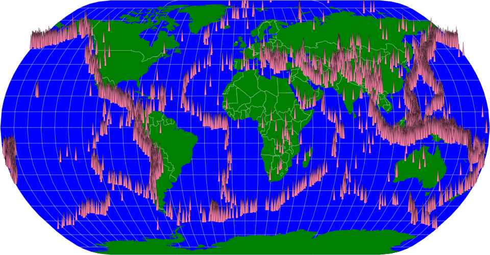
A world map showing earthquakes with magnitude and dates since 1965 constructed using the vega-lite-api. The Significant Earthquakes from 1965 dataset has been used for this visualization. This dataset contains information of earthquakes all over the world that took place from 1965. Dataset obtained from Kaggle.
MIT Licensed