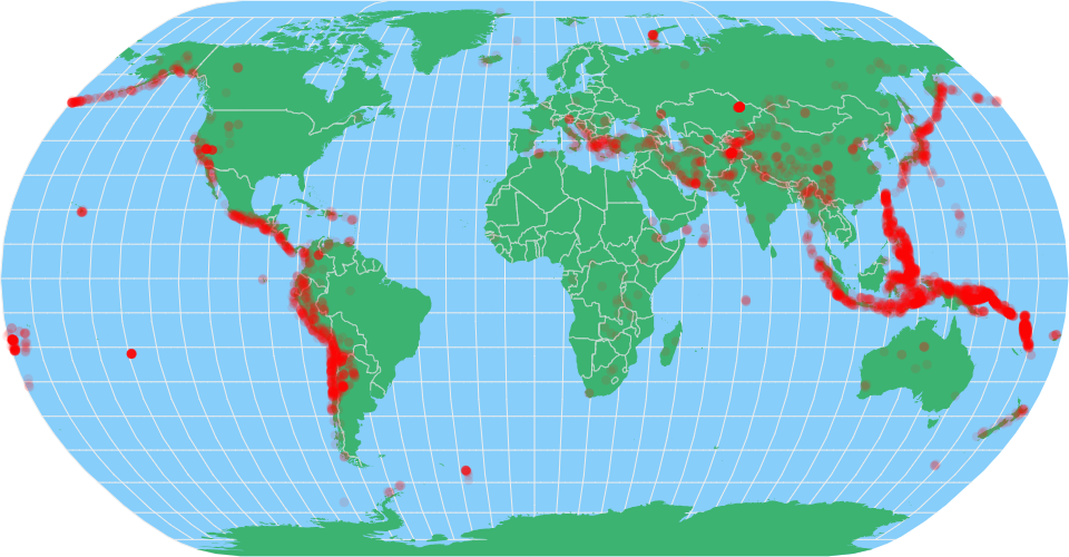
A world map showing earthquakes with magnitude and dates since 1965 (a realization of my first sketch) constructed using the vega-lite-api. The Significant Earthquakes from 1965 dataset has been used for this visualization. This dataset contains information of earthquakes all over the world that took place from 1965. Dataset obtained from Kaggle. Country boundaries from World Atlas TopoJSON, polished for visual style, including graticules.
Upon hovering onto any point, the tooltip displays the name of the Country and the Magnitude of the earthquake.
FUTURE WORK:
- Include zoom option on the Map
- Include a filter to visualize earthquakes by Year
MIT Licensed