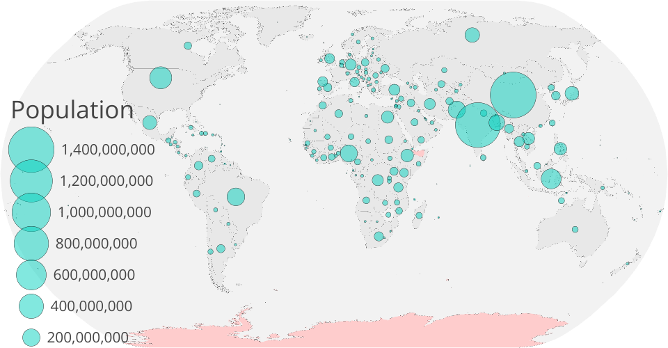
Visualizing population by country using circles on a map! The area of each circle corresponds to the population of the country it represents. You can also pan & zoom, and hover over each country for more information.
MIT Licensed
Visualizing population by country using circles on a map! The area of each circle corresponds to the population of the country it represents. You can also pan & zoom, and hover over each country for more information.