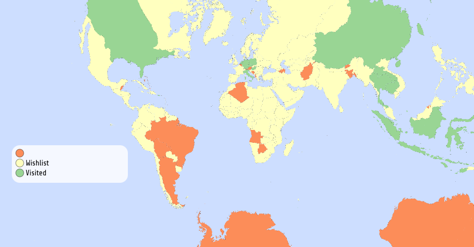
Interactive Worldmap with geoStereographic view. It demonstarte which countries Chawin S. has visited. The Orange color on the map indicate that the JSON file is responsive. The problem is I manupulate on only tsv but json.
dataForclass-HW/test3 - Sheet1.tsv
Bostock: Dataset for title function to return country names
The Data is pulled from unpkg file and linked based on adm0_dif. The data can be change if prefer.
MIT Licensed