Tooltips are basic hovers. It may take a couple of seconds to load and you have to click on the visualization first
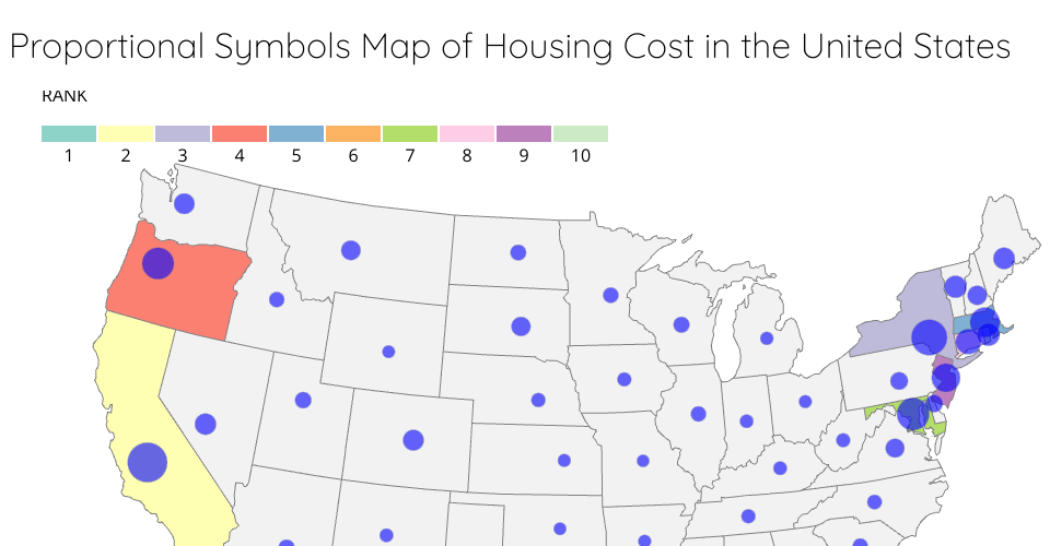
Data is from https://www.ers.usda.gov/data-products/county-level-data-sets/download-data/ and https://inkplant.com/code/state-latitudes-longitudes and https://www.cs.usfca.edu/~apjoshi/cs360/data/expensive-states.csv Used chapter 14 of Scott Murray's Interactive Data Visualization as Reference
MIT Licensed