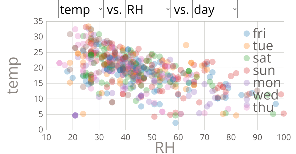
Scatter Plot of Forest Fires Attributes
This dataset is from P. Cortez and A. Morais. A Data Mining Approach to Predict Forest Fires using Meteorological Data available at http://www.dsi.uminho.pt/~pcortez/fires.pdf and https://archive.ics.uci.edu/ml/datasets/forest+fires
https://gist.github.com/mkt-ds/b4c757ad6ff0424c44cff6b6439cccb8
The main question I try to answer in this dataset is what are the contributing factors to forest fires? Is there a specific time of the year and other combinations together, like extra heat or wind or even the day of the week in case they are cause by humans camping?
Number of Instances: 517
Number of Attributes: 12 + output attribute
X - x-axis spatial coordinate within the Montesinho park map: 1 to 9 Y - y-axis spatial coordinate within the Montesinho park map: 2 to 9 month - month of the year: "jan" to "dec" day - day of the week: "mon" to "sun" FFMC - FFMC index from the FWI system: 18.7 to 96.20 DMC - DMC index from the FWI system: 1.1 to 291.3 DC - DC index from the FWI system: 7.9 to 860.6 ISI - ISI index from the FWI system: 0.0 to 56.10 temp - temperature in Celsius degrees: 2.2 to 33.30 RH - relative humidity in %: 15.0 to 100 wind - wind speed in km/h: 0.40 to 9.40 rain - outside rain in mm/m2 : 0.0 to 6.4 area - the burned area of the forest (in ha): 0.00 to 1090.84