The final version of the Data Visualization final project.
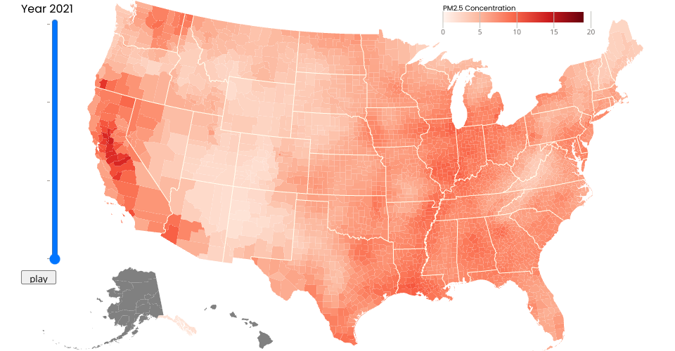
Data of PM2.5 concentration from PM2.5 by County.
County and state boundries from US county altas.
Adapted and extended from Mass School District Boundaries
Inspired by Choropleth.
MIT Licensed