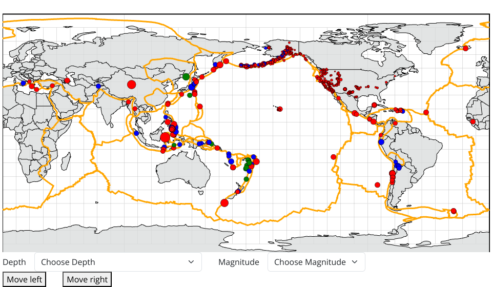
This map intuitively shows that the majority of the earthquakes occurred along the boundaries of the plates. There are more earthquakes around the Pacific Ocean than in other places on Earth. The region along the south coastline in Alaska and the west coast of America has the most seismic activity. These earthquakes are predominantly less than Magnitude 2.5 (M2.5). Luckily, this is a level that won't cause damage and is not felt by humans. Click and Check the Earthquake Magnitude Scale, cited from Michigan Tech.
- use data from an API
- circle size related to magnitude value
- interaction: click circle and direct to a url
- added color to the circles, according to depth (shallow, intermediate, deep)
- added interaction: dragging to make the earth turn left and right.
- added dropdown menus. User can select to view earthquakes by choosing depth and magnitude.
- added tooltip
- added zoom
MIT Licensed