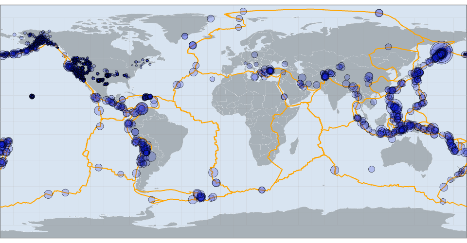
A world map showing earthquakes happened in the past 30 days.
See also https://vizhub.com/curran/8373d190b0f14dd89c07b44cf1baa9f9
Comments
See also https://vizhub.com/curran/8373d190b0f14dd89c07b44cf1baa9f9