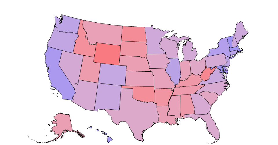
Electoral map for the 2020 election. Bluer states voted Democrat in higher proportion, redder states voted Republican in higher proportion, and neutrally colored states are closer to "swing" states.
Uses a US Election 2020 dataset for presidental election data, and the publicly available TopoJSON USA map.
MIT Licensed