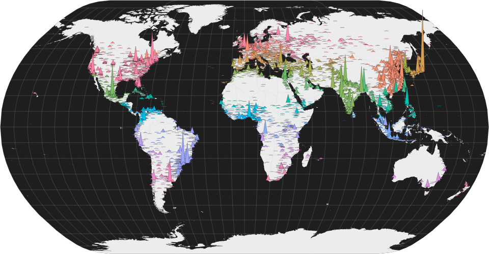
A world map showing cities with population greater than 50,000.
- Height represents population.
- Color represents country.
City data from Simplemaps: World Cities Database.
Country boundaries from World Atlas TopoJSON, polished for visual style, including graticules.
Colors inspired by UNHCR Streamgraph Explorer.
Technique inspired by New York Times: See How the Coronavirus Death Toll Grew Across the U.S..
MIT Licensed