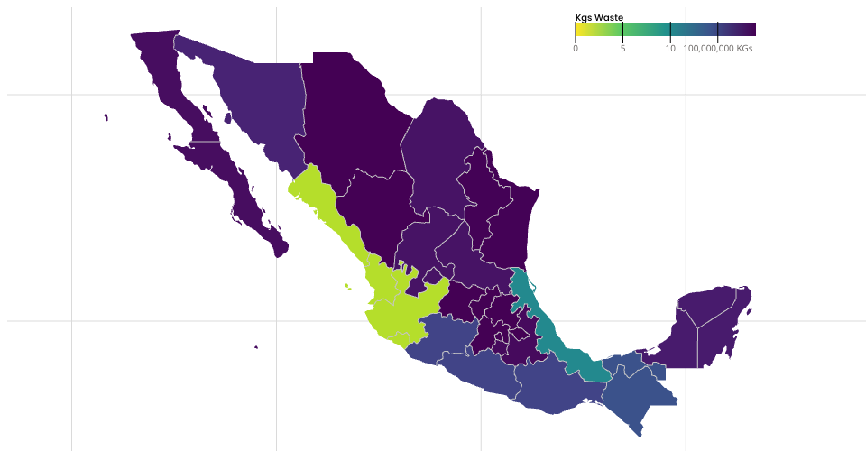
used arcgis.com data for plotting states and boundaries mapshaper.org to create JSON of states witin mexico using mercator projection Still need to center on the rendered image