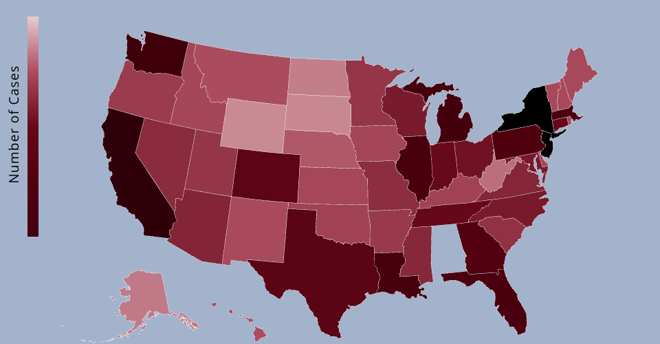
This map is a visualization of known COVID-19 cases in each U.S state as of 1:30 P.M. E.T., Mar. 27.
- Hover to see the state name
- Mouseover to see the number of cases.
- Click to toggle show/hide the number of cases.
Data Source: State and local health agencies, hospitals, C.D.C. https://www.nytimes.com/interactive/2020/us/coronavirus-us-cases.html
MIT Licensed