Bangladesh map interaction with sales data
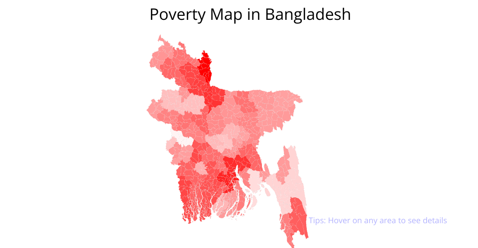
The problem is to visualize Poverty Data on Bangladesh map.
What I have done:
- Parsed topoJson Data to generate Map with geoJson from D3.
- Parsed sales data and maped with each District
- Constructed String for Hover data
- Applied Zoom and Drag feature as required
TopoJSON Data for Bangladesh:
https://raw.githubusercontent.com/techslides/D3-Maps/master/data/world/country/Bangladesh.topo.json
Data Source :https://github.com/emon535/bangladesh-geojson/blob/master/povertydataBD.json
Author Profiles:
- Codepen : http://codepen.io/emon535
- Linkedin : https://www.linkedin.com/in/emon535/
- Github : https://github.com/emon535
MIT Licensed