USA Education Choropleth Map
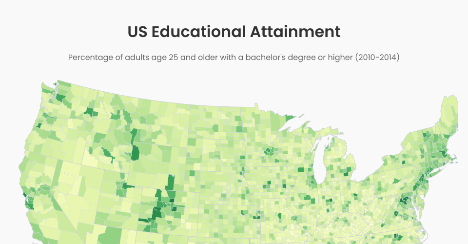
This project visualizes United States educational attainment data with a choropleth map. The map shows the percentage of adults age 25 and older with a bachelor's degree or higher in each US county (2010-2014).
Features
- Interactive choropleth map of the US showing education data by county
- Color legend indicating education percentages
- Tooltip on hover showing detailed information for each county
- Responsive design that works on different screen sizes
Technologies Used
- React.js for UI components
- D3.js for data visualization
- TopoJSON for map data processing
Data Sources
- Education data: U.S. Department of Agriculture Economic Research Service
- Map data: U.S. Census Bureau
MIT Licensed