An early version of the final project.
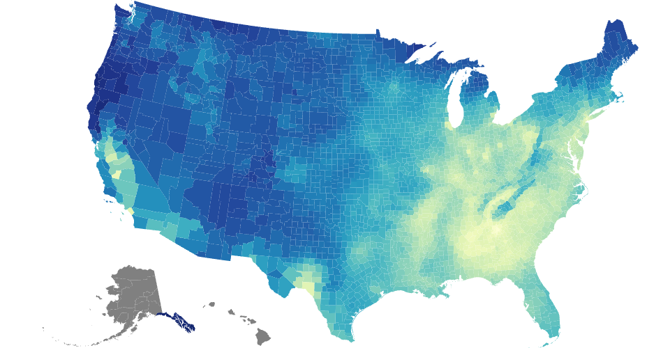
- <input checked="" disabled="" type="checkbox"> Marked area with no data record by grey color.
- <input checked="" disabled="" type="checkbox"> Drew a wireframe of the US map with counties.
- <input checked="" disabled="" type="checkbox"> Filled the wireframe by the PM2.5 concentration data in 2000.
Data of PM2.5 concentration from PM2.5 by County.
County boundries from US county altas.
Adapted and extended from Mass School District Boundaries
Inspired by Choropleth.
MIT Licensed