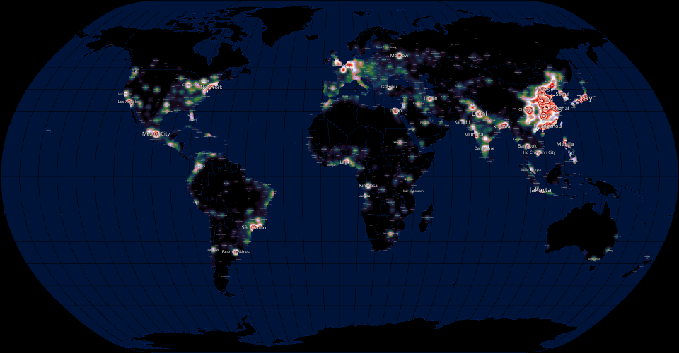
A contour map visualization of population density across the world, estimated based on populations of large cities. Features panning & zooming, and a label placement algorithm that uses an R-Tree spatial index to avoid overlaps.
MIT Licensed
A contour map visualization of population density across the world, estimated based on populations of large cities. Features panning & zooming, and a label placement algorithm that uses an R-Tree spatial index to avoid overlaps.