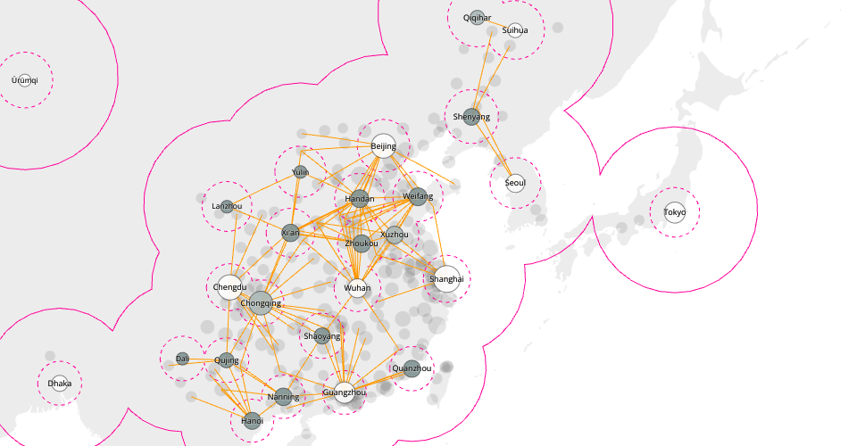
Experimental algorithm for filtering place labels.
Gray dots are all the cities in the input data, which are features from OpenStreetMap tagged with place=city. (Cities in India are missing from this dataset)
Highlighted dots show biggest cities with all their smaller neighbors (within a given radius) filtered out.
Country boundaries from World Atlas TopoJSON, polished for visual style. (That part forked from Sized Points on a Map)
ISC Licensed